Preparation of the inventory of municipal networks and the development and implementation of a geographic information system (GIS).
Geogram in figures
Since
2025
Projects
+0
Experts
+0
Sanitation Network with Mobile Mapping
In order to modernize the current management of the sewage networks, the Siero City Council relied on Geograma for the elaboration of the inventory of municipal networks and the development and implementation of a geographic information system (GIS).
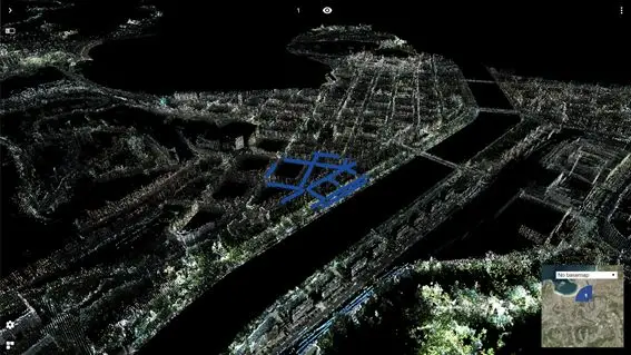
Once the project has been defined and designed, we have started with the inventory data collection. For this purpose, the company Geograma, pioneer in the use of Mobile Mapping technology in Spain, is using this technique to carry out the photographing and 3D scanning of streets and roads in Siero. With thousands of 360º photographs and millions of scanned points, the visible elements of the sanitation inventory will be positioned and then inspected in situ.
Solution
A vehicle equipped with positioning sensors, cameras and a 3D scanner will travel around the municipality capturing all the necessary details to create a professional Street View.
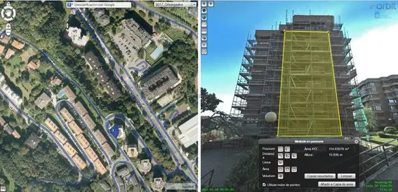
Municipal technicians will have the Orbit tool to perform inspections and measurements with topographic precision of any corner of Siero, without the need for costly travel, improving municipal management and maximizing the level of safety in their work. Measuring the height of a cornice or the vertical surface of a facade will be done with a couple of clicks from the office.
Other municipalities such as San Sebastian, Seville and A Coruña use this technology to improve municipal management.
With this project, the City Council of Siero will make economically accessible the use of advanced technological tools for the management of infrastructures and services and will improve the management of sanitation in the council, making the available human resources profitable.