
Sectors
Where are GIS and Location Intelligence solutions applied?
Geographic information is a strategic resource with applications in multiple sectors.
The following are the areas in which we provide expertise and value:

Infrastructure, Public Space and Mobility
Our GIS services specialize in addressing the challenges of infrastructure, asset management in public spaces, and urban and interurban mobility.
Through the use of Geographic Information Systems technology, we provide effective solutions for the planning and maintenance of critical infrastructures, optimize the management of resources in public spaces and improve planning, traffic, mobility and security systems.
Our approach helps cities and organizations address complex urbanization, congestion and resource management issues by transforming geospatial data into actionable insights for smarter and more sustainable land management.
Urban Planning, Spatial Planning and the Environment
Range of GIS services focused on land management, urban planning and environmental conservation.
We offer advanced solutions in Geographic Information Systems to meet the challenges of sustainable urban development, spatial planning and natural resource management. We facilitate decision making in urban planning projects, revitalization of urban areas and conservation of natural spaces.
With specialized tools for land analysis, land use change monitoring and climate change mitigation strategies, our GIS systems are key to effective land management.
Take advantage of our solutions for smart city planning, responsible environmental management and sustainable territorial development policies.


Real Estate, Real Estate, Appraisal and Fintech
We offer specialized solutions for the dynamic world of real estate. Surveying and real estate consulting to ensure accurate and effective delineation and management of your assets.
Our focus is on land delimitation, detailed real estate inventory, and expert consulting in urban planning, cadastre and registration for the purchase and sale, valuation and development of properties.
With extensive experience in the real estate industry, we employ the latest surveying and mapping technologies to provide highly accurate surveying services essential for project planning, boundary dispute resolution, and regulatory compliance.
Energy
We provide specialized GIS services to support the planning, operation and maintenance of energy infrastructures.
Our solutions allow you to analyze the network, optimize asset location, manage technical and environmental data, and improve decision making in renewable energy, electricity distribution, gas or energy efficiency projects.

Architecture, Engineering and Construction
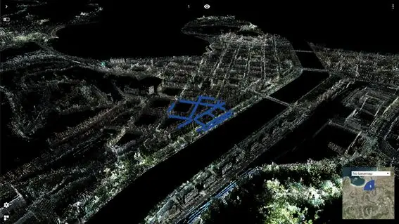
We offer specialized services that optimize the workflows of architects, engineers and builders, integrating GIS/BIM contexts into their projects and improving collaboration between teams throughout the infrastructure lifecycle.
Industry
We offer geotechnological solutions oriented to the digitalization of industrial environments through indoor mapping, virtual commissioning and 3D modeling techniques.
We facilitate the planning, simulation and optimization of production spaces, improving operational efficiency, asset management and decision making in complex industrial environments.


Security, Defense and Emergencies
We offer advanced geotechnical solutions for decision support in critical contexts.
Our GIS services enable real-time monitoring, spatial risk analysis, operations planning and efficient resource management in emergency, public safety or defense situations.
Marketing and Advertising (OOH)
We apply GIS solutions to optimize outdoor advertising campaigns (Out Of Home), through geospatial analysis of audiences, impact points and coverage.
We help plan and segment strategic locations, evaluate media performance and improve the effectiveness of marketing actions based on territorial and mobility data.


Technology and GeoData
We specialize in licensing geospatial data from leading providers such as TomTom and Here, as well as advanced tools such as GeoGenerator, Geo-Cassini and FME.
Our offer also includes map hosting services and specialized technological solutions for the processing, analysis and visualization of geospatial information.
Our clients are mainly technology, information systems and data governance departments within public administrations and private companies, which require robust solutions for the efficient and secure management of spatial data.
We provide value by facilitating access to cutting-edge technology and reliable data, which are essential for strategic location-based decision making.
Ports, Transportation, Logistics and Last Mile Distribution
We offer specialized Location Intelligence services to optimize the planning, operation and management of logistics and transportation infrastructures.
We apply GIS solutions to improve port efficiency, merchandise traceability, route analysis and last mile distribution, facilitating more agile and data-driven decision making.
Optimizes fleet management with real-time information
Reduce costs, save time and improve sustainability by digitizing your fleet. Benefit from our highly accurate location data and advanced algorithms.
- 20% potential reduction in fleet management costs
- 90% potential reduction of redirection times
- 20% potential increase in driver productivity
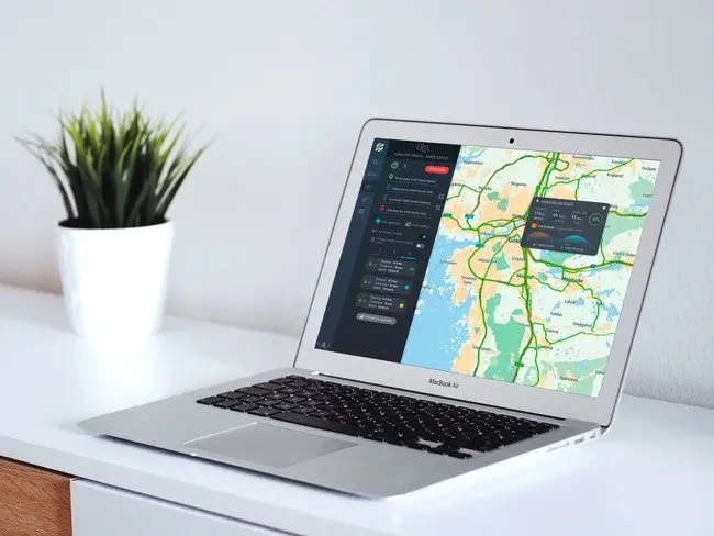
Brings more insight and efficiency to fleet management
- Analyzes and optimizes fleet operations in real time
Review, analyze and understand fleet performance for real-time decision making and forecasting. Plan and execute your delivery shifts in one place.
- Gain full visibility of fleet movements and status
Track your commercial vehicles in real time to manage potential delays. Build operator confidence and satisfy customers with real-time estimated arrival times.
- Increases driver productivity with more efficient routes
Generates routes based on truck size, load and driver experience for greater safety and compliance. Assigns the right jobs to the right drivers.
Reimagine your supply chain with end-to-end visibility
Detects outages and problems with real-time tracking and accurate ETAs.
- 50% reduction in dwell time
- 50% decrease in the cost of returnable assets
- 50% Less time spent searching for assets
Take control of your supply chain
- Reduce costs with real-time asset visibility
Avoid idle assets and low inventory levels. See how forklifts, containers or roll cages are used.
- Helps maintain service level agreements
Reduce time spent guessing ETAs by monitoring the location and status of your shipments.
- Discover next-generation visibility
Improve your event planning and forecasting process to enhance stakeholder collaboration, risk mitigation, agility and project optimization.
CONTACT WITH US
If you want to have some of our services contact us and we will advise you to give you the best solution.