
LiDAR Point Clouds and Mobile Mapping
At Geograma we provide administrations and companies with high-precision geospatial data to manage, plan and transform the territory.
Third coverage LiDAR
We have LiDAR point clouds with national coverage, density of 5 points/m² and an altimetric accuracy of 10 cm.
These data allow:
- Analyze the altimetry of the terrain in detail.
- Carry out flood studies, profiles and topographic measurements.
- Integrate altimetric information in engineering and planning projects.
In addition, we help regional governments, councils and town halls to share and disseminate these point clouds, both internally and to the public, through interactive web viewers that allow you to consult the elevation of any element.
Integration with Mobile Mapping, ground scanning and BIM
We facilitate the integration of LiDAR with other data sources such as:
- Mobile Mapping
- Terrestrial scans
- BIM models
All of this is visualized and managed from a single point cloud viewer, including data hosting.
Mobile Mapping: 360° images and urban point clouds
Thanks to our Mobile Mapping technology we generate point clouds and 360 georeferenced images that allow:
- Inspection and audit of assets in urban environments and roads.
- Infrastructure management and maintenance, detecting cracks, sinkholes, potholes and pavement wear.
- Control of street furniture (lampposts, traffic lights, benches, canopies, containers, etc.).
Urban planning and development
Our data supports municipalities in:
- Inventory of urban assets.
- Control of the occupation of public space.
- Management of green areas.
- Urban mobility planning: study of traffic lights, intersection visibility, location of pedestrian crossings, accessibility and parking management.
Utility management
Our solutions allow complete control of networks and services, both overhead and subway:
- Street lighting and overhead wiring.
- Telecommunications network (antennas and lines).
- Subway point cloud inspection of wells and trenches.
Digital maps
Proprietary maps, such as TomTom MultiNet and HERE Maps, provide high-quality data from satellites, real-time sensors, proprietary sources and user input.
Digital maps
These products include a solid base of cartographic layers that enable essential navigation and geographic analysis solutions. Components include basic road network, road topology, administrative boundaries and address data with geocoding capabilities. They also incorporate basic points of interest (POIs), hydrographic information such as rivers and lakes, and the main rail network.
Added to this are the geographical names of cities, towns and neighborhoods, toponymy in multiple languages, and key elements for navigational usability such as basic restrictions, functional classification of roads and limited height data.
All this with coverage adapted to the country or region.
Key benefits
Global Coverage
- Presence in more than 200 countries and territories.
- Level of detail adjustable according to country (Essential vs. Advanced).
Accuracy and Updating
- High data fidelity from multiple sources (vehicles, satellites, users, etc.).
- Frequent updates ensure fresh and reliable maps.
Data Richness
- More than 60 layers of data: from administrative boundaries to lane features, POIs, real-time traffic and more.
- Information for navigation, logistics planning, geospatial analysis and autonomous vehicles.
Ease of Integration
- Access via APIs, SDKs, web services and data packages.
- Compatible with GIS tools, mobile apps and cloud platforms.
Use Cases in Various Industries
- Ports, Transportation, Logistics and Last Mile Distribution. Route optimization, fleet tracking, electric vehicle (EV) fleet management.
- Urban Planning, Spatial Planning and Environment: land management, urban planning and services.
- Marketing and Advertising: location analysis and geographic segmentation.
Localization APIs
We provide a broad set of APIs that enable the integration of location functionality into applications and systems. These APIs are designed to solve use cases in multiple industries and mobility scenarios.
Localization APIs
The location APIs allow address geocoding, location searches, automatic suggestions and reverse geocoding. In routing, they support path planning for different modes of transport (vehicles, pedestrians, bicycles, public transport and electric vehicles), toll calculation, optimal routes with multiple stops and range areas (isolines). In addition, they facilitate visualization with vector maps, raster maps, static images and satellite photographs. They also include specific tools for intermodal transportation, integrating options such as park and ride, bicycles and cabs. All this is supported by a robust and scalable global infrastructure.
They are mainly grouped into the following categories
Geocoding and Searching
- Geocoding API: converts addresses to geographic coordinates (lat/lon).
- Reverse Geocoding API: converts coordinates into readable addresses.
- Autosuggest and Autocompletion: suggests places and addresses as the user types.
- Batch Geocoder: process multiple geocoding queries at once.
- Browse & Lookup APIs: search for places by type or ID.
Routing
- Routing API: routes for vehicles, pedestrians, bicycles and public transportation.
- EV Routing: optimized routes for electric vehicles, including energy consumption and charging points.
- Isoline Routing: defines areas reachable in time or distance from a point.
- Matrix Routing: massive calculation of routes between multiple points (origin-destination).
- Waypoint Sequencing: optimizes the order of multiple stops.
- Route Matching: aligns GPS data with real routes on the map.
- Toll Cost Calculation: estimates toll costs on a route.
Maps and Visualization
- Vector Tile Service: vector maps for dynamic rendering.
- Raster Tile Service: pre-rendered map images.
- Map Image API: generates maps as static images.
- Satellite Imagery: access to satellite images.
Public and Intermodal Transportation
- APIs to plan combined routes (public transport + bicycle, cab, etc.).
- Real-time information and route planning using public transportation.
- Cases such as “park and ride”, “bike and transit”, and “cab and ride”.
Use Cases by sector
Ports, Transportation, Logistics and Last Mile Distribution
- Delivery route optimization
- Real-time fleet tracking
- Toll costing
- Truck routing considering restrictions (weight, height, etc.)
- Delivery zone planning and coverage
- Dynamic assignment of deliveries from the nearest warehouse
- Live order tracking
- Nearest store locations
- Geospatial analysis for business expansion
Infrastructure, Public Space and Mobility
- Integrated vehicle navigation
- Routes for electric vehicles with consumption and charging points
- Dynamic maps and OTA updates
- ADAS and map-based assisted driving systems
- Optimal allocation of passengers and drivers
- Accurate calculation of ETA
- Efficient routing with real-time traffic
- Customer journey visualization
- Urban traffic management
- Public transportation planning
- Citizen mobility analysis
- Accessibility and isolation models
Integration
Our no-code ETL solution for GIS connects all your sources (spatial databases, OGC/APIs services and CAD/CSV/GeoJSON files), validates and transforms data, and orchestrates scheduled or real-time loads with full traceability. Centralize information in your GIS systems and analytical platforms, reduce manual errors and accelerate deployments. Result: consistent, up-to-date data ready for analysis and decision making.
ETL of data transformation and integration in GIS systems.
Bring your geographic data to life with our no code ETL solution.
We offer you a codeless ETL solution that connects and integrates all your data in a simple way, allowing it to flow automatically to where you need it and at the right time. Forget about manual processes and centralize your information to make faster, safer and more efficient decisions.
GIS Infrastructure
Our 3D georeferenced topographic data platform ingests point clouds, 360° and 3D/BIM models; normalizes and indexes; offers web visualization with measurements; version/permission control; CAD/GIS/BIM integration and API; and public/private/hybrid cloud deployment.
3D geo-referenced topographic data platform
3D geospatial information is transforming local management.
More and more city and county councils are receiving 3D data and BIM models from engineering, architectural and surveying firms. However, the efficient management of this information is still a challenge: different formats, poorly integrated workflows and complex tools make it difficult to make real use of it.
Store, manage and get the most out of your geospatial data
Our platform allows you to work with all kinds of technical and visual information:
- Intelligent storage of point clouds, 360° images, 3D/BIM models and CAD/GIS data.
- Inspection, measurement and digitization of assets and infrastructures with total accuracy.
- Secure and accessible sharing of information between teams, suppliers and citizens.
- Process automation through artificial intelligence tools.
- Open data integration and development of proprietary applications through our API.
No-code platform for publishing webGIS applications
Design and publish web maps without limits – without writing a single line of code.
We offer you a NO CODE solution to create and manage interactive web maps, accessible from any device. Import your geographic data, configure your map and share it easily with whoever you need.
- Design cartographic applications in HTML5
- Fully responsive and adapted to mobile, tablets and desktop.
- Instant publishing without dependence on developers
Total Access and Connectivity
Connect your maps to real-time data sources, from spatial and enterprise databases to web services. Compatible with INSPIRE and OGC standards, it guarantees data and metadata interoperability.
Customize and Share with Ease
Organize layers, base maps and thematic data in an intuitive way. Create customized geographic analyses and dynamic dashboards, ready to share with your team or the public.
Create WebGIS Applications in Minutes
Design web and mobile applications without programming, with interfaces adapted to your visual identity. Publish with a single click on portals, intranets or app stores.
GeoServicios® Cloud - Your GIS hosting in the cloud
Looking for a complete GIS solution, without worrying about servers, maintenance or scalability? GeoServicios® Cloud is your safest bet.

- Specialized hosting for geographic solutions, either with commercial or open source GIS technology.
- Availability in public, private or hybrid cloud, according to the needs of your organization.
- We take care of sizing, maintenance, security and performance, so you can focus on data and data analysis.
Unlock your infrastructure and scale your GIS with confidence.
SafeGIS - Security and peace of mind for your GIS infrastructure
Protect your GIS system from 100 € per year per component with a continuous, proactive monitoring service adapted to your technological environment.
What does SafeGIS offer you?
- Proactive and continuous security. Active monitoring of vulnerabilities and threats, with expert assessment and alerts relevant to your environment.
- Prevention and cost savings. Early risk mitigation that avoids outages, data loss and unexpected expenses.
- Longer software life. Implementation of improvements and updates that strengthen the resilience of your system.
- Planning and efficiency. Clear information on life cycles and obsolescence to plan smooth migrations and upgrades.
- Competitive advantage. Secure and updated systems that drive more innovative and quality services.
- Resource optimization. Reports tailored to your operations, with preliminary recommendations that facilitate decision making without overloading your team.
- Guaranteed regulatory compliance. Aligned with key regulations such as NIS2, ENS and ISO standards, facilitating audits and certifications.
SafeGIS is more than support: it is your digital shield for an efficient, up-to-date and always protected GIS.
Specialized Services
LiDAR Point Clouds and Mobile Mapping
At Geograma we provide administrations and companies with high-precision geospatial data to manage, plan and transform the territory.
CONTACT WITH US
If you want to have some of our services contact us and we will advise you to give you the best solution.
What are we experts in?
Projects in LiDAR Point Clouds and Mobile Mapping
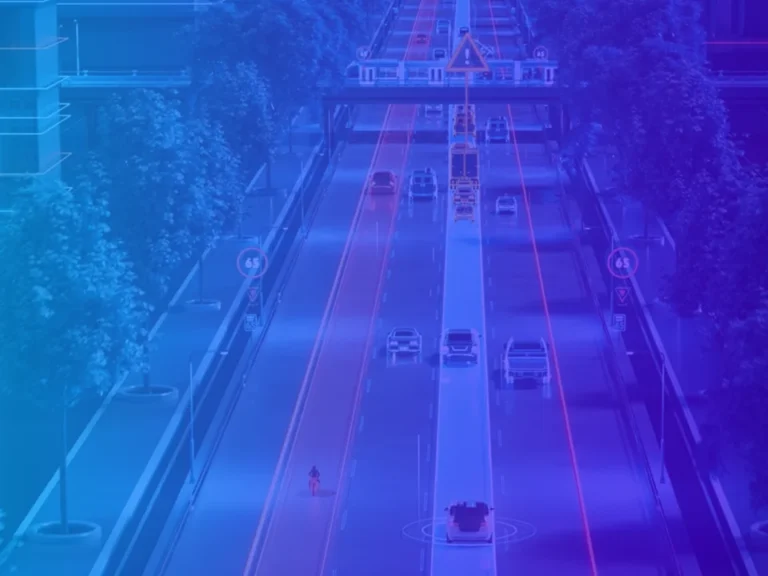
Georeferenced Data
Georeferenced data allows information to be accurately located in space, providing a solid basis for analysis, planning and decision making.
Thanks to the combination of technologies such as point clouds, 3D models and BIM, it is possible to work with a faithful representation of the territory and its infrastructures, facilitating from topographic studies to complex urban projects.