
Having explained the importance of accurately and reliably knowing the current state of a road infrastructure in order to undertake a BIM project that modifies it, in this article we will identify the key points that characterise a BIM model of the current state of road infrastructures.
Geograma, with the development of the BIM modelling service of the current state of road infrastructures, aims to respond to the following shortcomings currently faced by engineering companies and infrastructure management administrations:
- Aims to resolve knowledge of the current state of the road infrastructure to engineering companies that carry out BIM projects of the road on which the project is to be carried out. It is currently NOT resolved, as it is based on partial information, which leads to inaccuracies in the initial BIM model.
- Likewise, given the characteristics of the initial BIM model, the administration managing the infrastructure shall have a reference BIM in order to be able to make insertions of other BIM projects developed by third parties for the detection of interferences. This aspect is currently NOT resolved, and the BIM projects received or to be received by the administrations cannot be positioned, as they do not have a reference scenario.
- And, without pretending to be pretentious, for the infrastructure and services sector in general, a BIM methodology applied to roads will be defined, which may represent an advance of the BIM methodology in civil engineering.
The BIM modelling service of the current state of road infrastructures developed in Geograma has the following components:
- A system for the mass capture of the current state of the road, which provides the 3D measurements necessary to represent any detail of the current state of the road and with sufficient precision, equivalent to traditional topographic means, reaching centimetric accuracy.
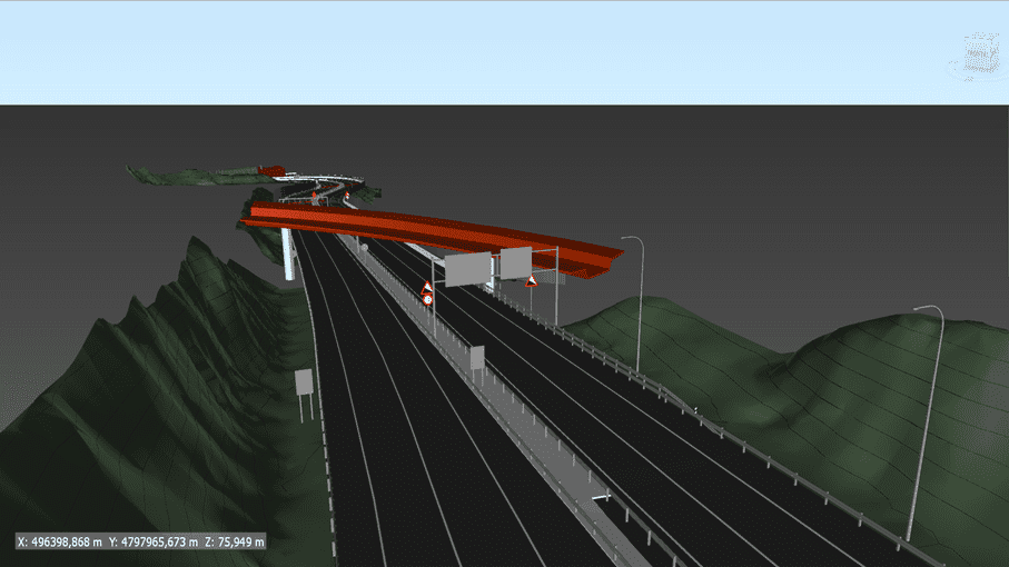
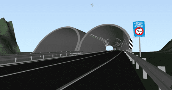
- A 3D geometry extraction system for modelling, which allows, from the data captured, the digitalisation of both the structural elements such as the roadway, tunnels, walls, bridges, etc. and the infrastructure equipment (protection barriers, signalling, beaconing, etc.).
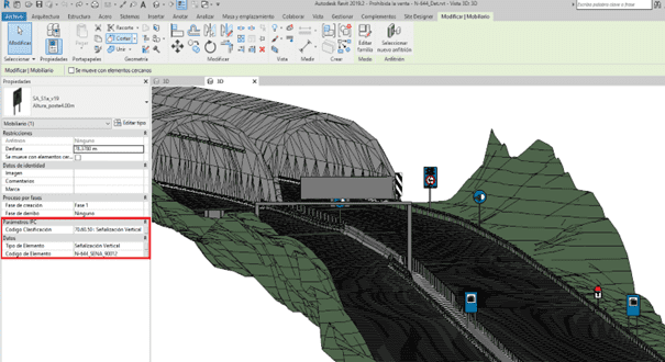
- The development of a BIM modelling system, which makes it possible to create a model of the structural elements and detailed elements of the equipment with the following characteristics: light, georeferenced, geometrically correct, coded and classified.
- It contemplates the edition, sharing and dissemination of the BIM model, so that engineering companies can carry out sectorisations or demolitions to include the BIM project that they carry out, as well as so that the administration can share and disseminate the reference BIM model to third parties.
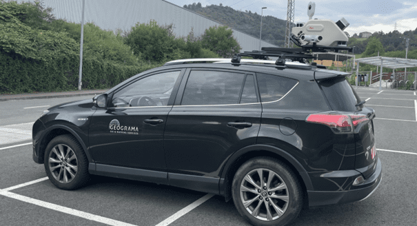
The system for the mass capture of the current road condition is based on Mobile Mapping Surveying technology (with topographic features), which allows obtaining a point cloud and 360 images to represent the road geometries with centimetric precision.
In our case, we use Leica technology, with the Pegasus 2 Ultimate and the new TRK. This mass capture can be completed in shaded areas with drones and ground scanning and for vegetated slopes and embankments, LiDAR flight is available.
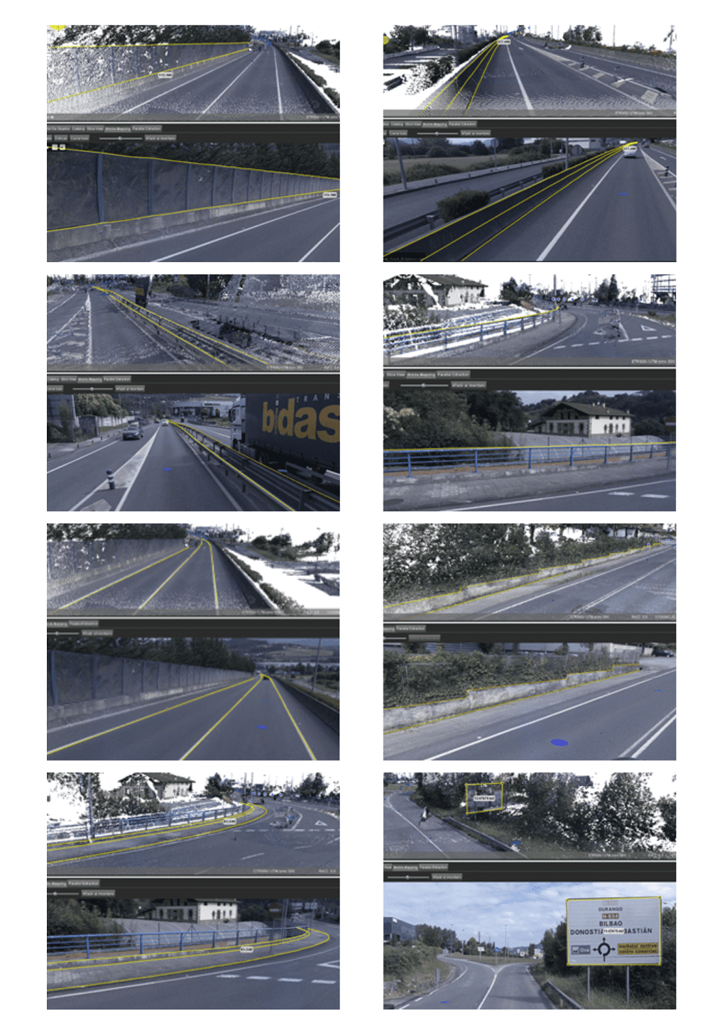
The 3D geometry extraction system for modelling is based on obtaining the geometries of the breaklines. Basing the 3D model on the points of the point cloud, even if generalised, to generate a mesh for a mesh model, we believe that this is not an appropriate strategy due to the large volume of our models.
Point clouds and 360 images allow us to obtain the edges of the objects, as a basis for the future georeferenced, lightweight and accurate model.
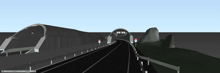
The BIM modelling system, is based on, from the data digitised in the previous module, generating the BIM models of the structural elements and the detail elements. As structural elements we have the ground (pavement, roadway, median, median crossing and ground), vertical elements (walls), structures (bridge, upper slabs and gables of masonry works and tunnels, vaults and pillars).
As detailed elements we have containment elements (new jersey, bionda, railing), signalling elements (edge markers, cylindrical beacons, vertex markers, directional panels), lighting elements (lampposts, floodlights), signalling elements (vertical signalling, luminous panel, gates and flags).

And finally, what is the BIM model of the current state of the road infrastructure used for? Firstly, as a scenario for inserting BIM models made by third parties, to check their georeferencing. But also as a starting model for the BIM design of a layout modification, a new structure, a variant, etc. These projects, once implemented, may be inserted to update the new infrastructure status, through sectorisation and demolition.
If after reading this article you feel identified with the problem and want to solve it, either from the point of view of the managing administration, or from the point of view of the engineering company that has carried out the project or from the point of view of the construction company that has executed the work and has to deliver the BIM model of the infrastructure, get in touch with Geograma.
Geograma has developed the BIM modelling service of the current state of road infrastructure with the help of the Álava Innova programme of the Provincial Council of Álava and with the experience of clients such as the metropolitan area of Barcelona and the Technology and Inventory Service of the Provincial Council of Bizkaia.